

Computer System Designing & Consulting Service; GRS provides comprehensive and experienced remote sensing and GIS services, training and consultation ...

Brand Licensing Integrated Security Surveillance Systems Cybersecurity Big Data Analysis Applications Border Management Perimeter Protection Solutions Command and Control Geographic Information Gis Geospatial Intelligence Intruder Detection Towers Coastal Safe Cities Counter Terrorism Investigations Gunshot Location Mapping Tracking Public Safety Technologies Predictive Policing Communications Equipment ...

Advanced Amr, Amr, Demand Response, Load Management, Sub Metering, Esco, Scada, Energy Efficiency, Irrigation Amr, Energy Information, Real Time, Energy Monitoring, Residential Metering, Commercial Metering, Industrial Metering, Peak Energy Pricing, Measurement and Verification; Security Equipment; AdvancedAMR - Wireless-to-Internet AMR and Energy Management solutions to monitor, manage and control energy usage in real time over large geographic areas; Wireless, For Online Energy Monitoring of ...

Crayon Are the Global Leader In Software Asset Management (Sam), Cloud and Volume Licensing and Associated Consulting Services and Are Trusted Advisors To Many of the Globe's Leading Organisations; Software Asset Management, Licensing & Consulting Services; Crayon Group, Technology Industry ...
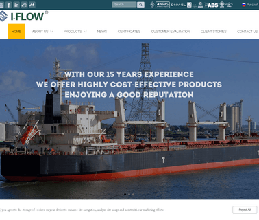
I FLOW is flow control products, including gates, globes, checks, butterfly valves, balls, JIS and DIN marine valves, strainers, actuating devices, flanges, pipes and fittings, with pressure range from 0.5 to 6.4MPa and size from DN15 to DN3000, Industrial Valves, Kitchen Utensils, Kitchenware, Marine Accessories ...

Visualization Software; Consulting Services; Image Processing; Mapping Tools; 3D Mapping Software & Tools; Gis Software; Aerial Imaging; Information Technology Products; Geographic Information Systems; Location Based Services ...
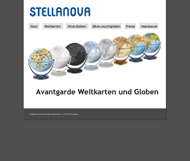
Globe: Computerized Globes, Illuminated Globes, Mini Globes. Globe, Giftware, Computer Equipment ...

World Maps, Wall Maps, Us Maps, United States Maps, Travel Maps, Trails Illustrated, Trail Maps, Topographic Maps, Topo, State Maps, Recreation Maps, National Park Maps, National Geographic Maps, National Geographic Magazine Maps, National Geographic, Maps, Map Software, Hiking Maps, Hemispheres Maps, GPS Maps, Globes, Education Maps, Country Maps, Continent Maps, Conservation Maps, City Maps, Cartography, Atlases, Antique Maps, Adventure Travel Maps; National Geographic Maps Makes the Worlds Best ...

The World & #39; S Biggest and Best Map and Travel Bookshop. for Over 160 Years, Explorers, Travellers and Adventurers Have Looked To Us as Map Specialists To Get Them Where They Need To Go, and Back Again; Maps, Atlases, Travel Guides, Travel Books and Globes Stanfords, Brand Licensing ...

GIS Mobile Technologies; Data Analytics, GIS Mobile Technologies; Field Inventory Services; Geographic Information Systems, Electric Power Transmission ...

Orbis World Globes is the world's leading designer & creator of NASA satellite image EarthBalls, for schools, museums, trade shows, festivals and parades, Childrens Toys, Educational Toys ...

Tshirts; Educational Products; Retailing Aides; Travel Planning; Travel Destinations; Fine Art; Books & Periodicals; Environmental Organization ...
Visualization Software; Research & Development; Cloud Computing; Engineering Services; Mapping Tools; Aerial Imaging; Geographic Information Systems; Commercial Satellite Imaging; Image Processing ...
Simulation & Modeling & Training; Research & Development; Aerial Imaging; Geographic Information Systems; Commercial Satellite Imaging ...
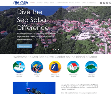
Sea Saba, Dive On Saba, Caribbean Dive Center, Centre, Dutch Caribbean, Island of Saba, Saba Island, Dutch Caribbean, Caribbean, Dive Center, Scuba, Dive, Trip, Diving Experience, Service, Quality, Great Boats, Professionalism, Underwater, Padi 5 Star Resort, Commitment, Padi National Geographic Dive Center, Sea & Learn, Sponsor, Uncrowded Boats, Island of Saba, Saba Island, Gay Friendly, Scuba Saba, Traveling To Saba, Romantic, Tiny Caribbean Island, Where To Stay, Saba Divers, Teams Genuine, Nature, Safety Equipment ...
North American Mapping, Nevada Aerial Mapping, Nam, Photogrammetry, Denver, Colorado, Nevada, Las Vegas, Reno, Aerial Photography, Ikonos, Remote Sensing, Photogrammetry, Aerial Camera, Aerial Mapping, Aerial Photography, Aerial Surveys, Aerial Triangulation, Aerotriangulation, Airborne Gps, Airborne Control Surveys, Cadmap/Dgn, Vrone, Vrtwo, County Mapping, Dem, Digital Elevation Model, Digital Mapping, Dtm, Digital Terrain Model, Gis, Geographic Information System, Gis Base Mapping, Gps, GPS Control ...