
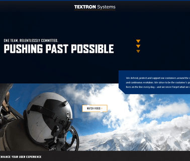
Textron Systems offers advanced geospatial intelligence solutions and hyperspectral imaging capabilities that support global and national defense, security, humanitarian assistance, environmental studies, forestry and urban planning. RemoteView delivers proven analysis and exploitation capabilities, as well as enhanced analytics that take advanced imagery data one step further ...

Optics Equipment Photonics Cctv Camera Access Control Integrated Security Surveillance Systems Border Management Identity and Perimeter Protection Solutions Fence Sensors Command Geographic Information Gis Geospatial Intelligence Intruder Detection Mobile Vehicles Patrol Towers Under Vehicle Cameras Coastal Infrared Night Vision Thermal Imaging Optical Optronics Design Centres Psim Physical Vms Video Unmanned Safe Cities Emergency Response ...

Brand Licensing Integrated Security Surveillance Systems Cybersecurity Big Data Analysis Applications Border Management Perimeter Protection Solutions Command and Control Geographic Information Gis Geospatial Intelligence Intruder Detection Towers Coastal Safe Cities Counter Terrorism Investigations Gunshot Location Mapping Tracking Public Safety Technologies Predictive Policing Communications Equipment ...
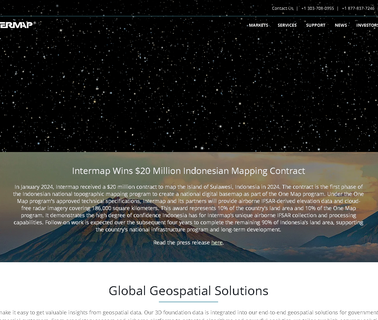
Intermap is an industry leader in geospatial intelligence solutions including, location based information, risk assessment, geographic information systems, engineering, utilities, GPS, oil & gas, renewable energy, hydrology, environmental planning, land management, telecommunications, transportation, and 3D visualization. Additionally, Intermap leads in geospatial data management and processing, including fusion ...
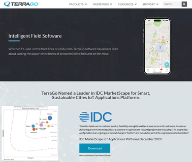
TerraGo develops innovative software for the dissemination and collaboration of geospatial intelligence between national systems and field operators for any mission, any location and any device. TerraGo invented the most widely adopted geospatial collaboration technology with its GeoPDF applications and is revolutionizing data collection with its TerraGo R3 mobile application ...

Ursa is on an unflinching quest to move the world forward by turning satellite data into impact and decision advantage. Founded in 2014, we pioneered transparency into oil data in China. Since then, we've expanded our global reach with geospatial intelligence products that set new standards for accuracy and reliability ...

Cybersecurity Cctv Camera Access Control Integrated Security Surveillance Systems Border Management Cbrn Detection Identity and Perimeter Protection Solutions Fence Sensors Command Geographic Information Gis Geospatial Intelligence Intruder Mobile Vehicles Patrol Towers Under Vehicle Cameras Coastal Infrared Night Vision Thermal Imaging Optical Optronics Design Centres Psim Physical Vms Video Unmanned Safe Cit ...
Cybersecurity Cctv Camera Integrated Security Surveillance Systems Border Management Cbrn Detection Perimeter Protection Solutions and Fence Sensors Command Control Geographic Information Gis Geospatial Intelligence Intruder Mobile Vehicles Patrol Towers Under Vehicle Radio Communication Cameras Coastal Infrared Night Vision Thermal Imaging Optical Optronics Unmanned Safe Cities Disaster Response Rescue Equipment Communications Swat Tactical Tr ...
Cctv Camera Integrated Security Surveillance Systems Cybersecurity Big Data Analysis Computer Forensics Digital Solutions and Investigation Document Internet Knowledge Management Mobile Online Secure Electronic Signature Software Applications Threat Border Perimeter Protection Fence Sensors Command Control Geographic Information Gis Geospatial Intelligence Intruder Detection Vehicles Patrol Towers Under Vehicle Radio Communication ...

GISCafe booth to win a $100 Amazon Gift Card. GISCafe is the #1 online magazine offering GIS and geospatial and geo intelligence professionals daily news, editorial, blogs, event postings, job placement and more. Contact Sanjay Gangal at sanjay@giscafe to book a time slot for a video interview. Drop in a business card at for a chance to win a $100 Amazon Gift Card ...

Orbital Insight develops geospatial analytics to unlock societal and economic trends at a global scale. We source petabytes of satellite, drone, balloon; UAV data. Using artificial intelligence and data science, we process and transform multi modal datasets into intelligence enabling businesses, governments, and NGOs to make better decisions ...
Hi, I'm Sarah Jenkins and I'm Glad you Found My Pet Blog. Thanks for Stopping By and I Hope that you find the Answers to all your Pet Questions. Enterprise information & communications technology (EICT) including software development, advanced security, network management, Oracle apps, ERP consulting & business intelligence, geospatial information systems (GIS) & engineering & design services (EDS) ...