

Electronics & Controls & Instrumentation, Communications Cellular, Wireless; Electronics & Controls & Instrumentation, Communications Satellite; Electronics & Controls & Instrumentation, Controls; Electronics & Controls & Instrumentation, GPS Global Positioning Systems; Information Technology, GIS & Mapping; Information Technology, Inventory & Equipment Management; Information Technology, Power & Process & Plant & Utilities; Safety & Security, Alarms; Services, Fleet Management Systems, Construction Equipment ...

Electronics & Controls & Instrumentation, Communications Cellular, Wireless; Electronics & Controls & Instrumentation, Communications Satellite; Electronics & Controls & Instrumentation, GPS Global Positioning Systems; Information Technology, GIS & Mapping; Information Technology, Inventory & Equipment Management; Safety & Security, Alarms; Safety & Security, Anti Theft & Security Systems; Services, Computer Software; Services, Fleet Management Systems; Services, Telecommunications; Services, Construction Equipment ...

Contractors, General; Equipment Repair; Mapping & Design & CAD & GIS; Repair Services; Telecommunications Services; Training & Educational Services; Wire and Cable; Turnkey Services & Project Management; Consulting Services; Disaster Recovery & Preparedness, Cable Telecommunications ...

Land Surveyors, Surveying, Civil Engineering; Aerial Mapping, Surveying & Engineering Services; Land Surveying and Civil Engineering Houston Texas; Land surveying services Boundaries, topo, GPS, GIS ...

Electronics, Controls, Instrumentation Computer Software; Information Technology Computer Hardware & Peripherals; Information Technology Financial Management, Project Accounting, Accounting Services; Information Technology Gis, Mapping; Information Technology Internet Solutions, Networking; Information Technology Inventory, Equipment Management; Information Technology Management Consulting, Asphalt Equipment, Heavy Construction ...

Law Enforcement Gear, Gis, Gps, Mapping, Ems, Public Safety, Esri, Trimble, Police, Fire, Cad, Rms, Addressing, Ambulance, Avl, Routing, Crime, Hotspots, Analysis, Data, Law Enforcement; Computer Networking Service; Innovative public safety GIS applications from BCS empower Police, Fire and EMS agencies to enhance protection and provide better services to their communities; Service ...

Brand Licensing Integrated Security Surveillance Systems Cybersecurity Big Data Analysis Applications Border Management Perimeter Protection Solutions Command and Control Geographic Information Gis Geospatial Intelligence Intruder Detection Towers Coastal Safe Cities Counter Terrorism Investigations Gunshot Location Mapping Tracking Public Safety Technologies Predictive Policing Communications Equipment ...

Rdo, Rdo Integrated Controls, Gis Mapping, GPS Mapping, Surveying, Agriculture Technology, Construction, Mining, Drone Technology, Drone, Drones, Drones for Sale, Sensefly; Rdo Integrated Controls Partners With Clients To Provide Cutting Edge Technologies and Drones for the Construction, Landfill and Mining Industries; Home Rdo Integrated Controls, Mining Industry ...
Mapping, Design, CAD, GIS; Network Management; Software, Applications; Telecommunications Services; Workforce Managements Systems; NOC Tools & Systems; Software Defined Network, Cable Telecommunications ...

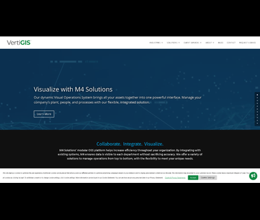
Visualization Software; Consulting Services; Image Processing; Mapping Tools; 3D Mapping Software & Tools; Gis Software; Aerial Imaging; Information Technology Products; Geographic Information Systems; Location Based Services ...

Information Technology, Construction Management; Information Technology, Cost Management & Estimating & Bidding; Information Technology, Financial Management & Project Accounting & Accounting Services; Information Technology, GIS & Mapping; Information Technology, Inventory & Equipment Management; Information Technology, Project Management & Control; Safety & Security, Anti-Theft & Security Systems ...

Robert E. Lee & Associates, is Located in Hobart, Green Bay, Wisconsin. Engineering, Surveying, Environmental Services, Municipal Engineering, Site / Land Development, Stormwater Management, Transportation Engineering, Wastewater Systems, City Water Systems, Water Towers, Civil Engineering, Floodplain & Drainage, Agricultural Engineering, Construction Services, Land Surveying Services, Funding Assistance, Ecological Services, Planning and Development, Gis & Mapping; Pollution Control, Environmental ...
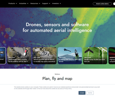
Drones, Uav, Uas, Rpas, Professional, Commercial, Survey, Imaging, Mapping, Gis; At Sensefly We Develop and Produce Aerial Imaging Drones for Professional Applications; Drones for Professionals, Mapping & Photogrammetry, Flight Planning & Control Software: Sensefly Sa, Solar Power ...
Information Technology Gis / Mapping; Safety & Security Pipe & Cable Locators; Safety & Security Sensors; Services Consulting ...

Coordinate Conversion, Gis File Format, Gis Developer, Geographic Calculator, Geocalc Sdk, Global Mapper, Global Energy Mapper, Global Mapper Sdk, Gis Software Tools, Gis Solutions, Lidar Module; Blue Marble's GIS software and training are used worldwide by GIS professionals who need affordable, powerful and easy GIS mapping solutions ...

Mapping, Design, CAD, GIS; Test; Traps and Filters; 644 and See What's new with Arcom; Along with its Decades Proven Subscriber Filters, Arcom Adds to its best of Class Network Monitoring and Leakage Detection Platforms with new Enhancements such as Integrated Pnm Tools that now Correlate Cpd Detection with Real Time Cmts Performance Monitoring. Additionally, Impairments can now be more Quickly located Due to the Addition of the first Non Service Interrupting Tdr Mode for Quiver, Cable Telecommunications ...