

Landworks, Provides Land Management and Gis Software and Services To Manage Any Land Right In Any Industry Anywhere In the World. Esri Gold Partner; Landworks, Innovative Land and Property Management Software, Wind Power ...

Visualization Software; Consulting Services; Image Processing; Mapping Tools; 3D Mapping Software & Tools; Gis Software; Aerial Imaging; Information Technology Products; Geographic Information Systems; Location Based Services ...
Mapping, Design, CAD, GIS; Network Management; Software, Applications; Telecommunications Services; Workforce Managements Systems; NOC Tools & Systems; Software Defined Network, Cable Telecommunications ...

Esri Gis (Geographic Information System) Software Enables Telecommunications Providers to Enhance their Operations and Gain an Advantage in an Increasingly Competitive Market by Integrating Location into their Business Processes. Gis Provides a Common Platform for Integrating Information from Across the Enterprise and Performing Advanced Analyses Based on Location. Our Solutions Enhance your Marketing Strategies, Optimize Infrastructure Built Outs (Such as Wifi), and Track Network Performance, Cable Telecommunications ...

Geo Information Systems for Municipal Administration (Software and Solutions); Software and Solutions for Cemetery Offices; Software and Solutions for Municipal Establishments, Municipal Public Utility Undertakings; Elfried Mobile; Elfried Gis; Jpax; Prosiris; Elfried, Digital Technology ...
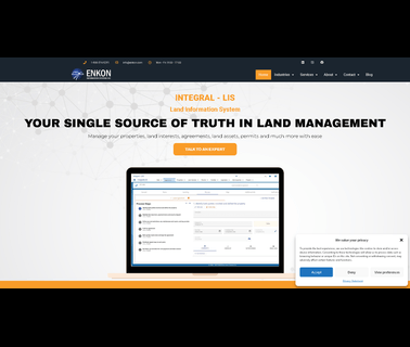
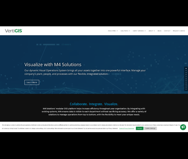
Real Estate Management Software, Busiiness Process Management Software, Environmental Management System, Safety Management System, Document Management Software, Land Management Software, Cloud Computing Model, Permit Management Software, Environmental Sustainability, Environmental Management, Land Management, Compliance Software, Document Management, Cloud Computing, Greenhouse Gases, Erp Software, Land, Safety, Gis, Esri, Saas, Ghg, Permit, Swppp, Wetlands, Viridian Cloudworks and Integral Cloudworks are ...
Electronics, Controls, Instrumentation Computer Software; Information Technology Computer Hardware & Peripherals; Information Technology Financial Management, Project Accounting, Accounting Services; Information Technology Gis, Mapping; Information Technology Internet Solutions, Networking; Information Technology Inventory, Equipment Management; Information Technology Management Consulting, Asphalt Equipment, Heavy Construction ...

Computer Hardware & Software; Communications; Cellular; Secure Communications Solutions; Wi Fi; Wireless Communications Equipment; GIS Mobile Technologies; Field Force Automation Products; Mobile Computing, Building Hardware, Electronic Batteries, Wireless Communications ...
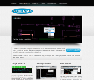
Lode Data, Design Assistant, Drafting Assistant, Fiber Optic, Fiber Module, Fiber Management Software, Broadband, Telecommunications, Radio Frequency, Cable Television, Splice Matrix, Catv, Pon, Fiber To the Home, Ftth, Cwdm, Esri, Gis, Oracle, Autocad, Scte, Society of Cable Television Engineers; Lode Data Corporation, Cable Telecommunications ...

Electronics & Controls & Instrumentation, Communications Cellular, Wireless; Electronics & Controls & Instrumentation, Communications Satellite; Electronics & Controls & Instrumentation, GPS Global Positioning Systems; Information Technology, GIS & Mapping; Information Technology, Inventory & Equipment Management; Safety & Security, Alarms; Safety & Security, Anti Theft & Security Systems; Services, Computer Software; Services, Fleet Management Systems; Services, Telecommunications; Services, Construction Equipment ...
Computer Hardware & Software; Information Technology; Information Technology; GIS Mobile Technologies; Field Force Automation Products, Electric Power Transmission ...
Emergency Equipment, Accident Gis Software, Collision Diagram, Accident Information Management, Accident Mapping Software, Safetyanalyst, Gis Safetyanalyst, Traffic Safety Software; Accident Software, Accident Gis Software, Accident Record, Accident Records; Accident Information Management, Accident Information Management System, Accident Data Management, Accident Record Management; Accident Analysis, Accident Analysis Software, Accident Mapping, Accident Mapping Software, ...

Envitia Work With Customers In Defence, Government and Industry To Make Better and Faster Decisions Through the Use of Geospatial Technologies and Gis Software Systems; Geospatial Information Systems Gis Software Envitia, Simulation Training ...
Gis Software; 3D Mapping Software & Tools; Data Analysis Software, Electric Power Transmission ...
Coordinate Conversion, Gis File Format, Gis Developer, Geographic Calculator, Geocalc Sdk, Global Mapper, Global Energy Mapper, Global Mapper Sdk, Gis Software Tools, Gis Solutions, Lidar Module; Blue Marble's GIS software and training are used worldwide by GIS professionals who need affordable, powerful and easy GIS mapping solutions ...
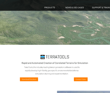
Terrasim, Terrasim 3D, 3D Visualization, Synthetic World, Terratools, Tsgfly, Roadmap, Terratours, Gis Data, Gis, Cartographic, Flight, Flight Simulation, Construct Complex Geospecific Virtual Worls, Virtual, 3D World, Cad, Models, Architecture, 3D Environments, Suburban, Urban, Desert, Software, High Technology, Steelbeasts, Steel Beasts, Vbs2, Onesaf, Otf, Jcats, Openflight, Sedris, Openscenegraph, Collada, Xtract, Database Reuse, Legacy Database; This is the Official Site of Terrasim, We ...