
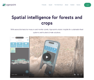
Agerpoint, Precision Agriculture Technology, Crop Management System, Crop Information Management System, Crop Management System, Ndvi Index, Data Mining, Data Visualization, Data Analysis, Data Collection, Agriculture Farming Solution, Precision Ag, Precision Agriculture, Lidar Sensor, Lidar Scanner, Gml100 Geiger Scanner, Ladybug Camera, 3D Point Cloud, 3D Laser Scanning, Rgb Point Cloud, Gps Tracking, Silviculture, Silviculture Analytics, Forestry Analytics, Agerpoint is an Agriculture Farming Solution ...
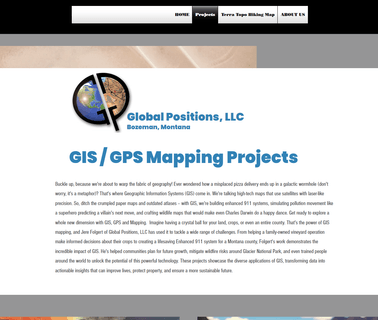
Gis, Mapping, Drone, Faa, Arcgis, Desktop, Training, Cartography, Award; Gis / GPS Mapping Firm; Consulting, Spatial Analysis, GPS Data Collection, Custom Mapping & Applications, Custom Integration, Software Development, System Integration & Assessment; GIS/GPS mapping firm. Consulting, spatial analysis, GPS data collection, custom mapping & applications, custom integration, software development, system integration & assessment ...
Founded with agriculture professionals in mind, Juniper Systems specializes in rugged data collection solutions built tough enough to operate in the scorching summer heat and withstand that unexpected downpour. From our rugged tablets, handhelds, and GPS receivers, to our HarvestMaster seed research systems, we have a solution to keep your crews productive and your yields high. Juniper Systems is also a proud, Electric Power Transmission ...

Gps Mobile Computers, Tethered Industrial Bar Code Scanner, Rugged Bar Code Scanner, Area Imaging Scanners, Laser Scanners, Intermec Industrial Scanners, Industrial Scanner, Laser Scanners, Linear Imaging Scanners; Barcode Computers: Handheld Barcode Computers, Portable Data Terminals, Collection, Collector, Barco, Mobile Computer ...

Pavement Management, Asset Inventory, Asset, Department of Transportation, Hpms- Highway Performance Monitoring System, Pavement Industry, Roadware, Pavement, Wisecrax, Pavement Data Collection, Lcms, Pavement Data, Surveyor, Aran, Roadware, Fugro Roadware, Asset Management System, Gps System ...
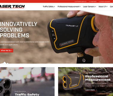
Reflectorless laser measurement technology is the perfect solution for field data collection. From capturing a distance, height or slope & grade measurements to GPS integration for laser offset mapping, our laser and mapping solutions let you capture accurate data safely and efficiently. the TruPulse 360R is the ideal construction laser to have in your toolbox. Measuring a stockpile volume using LTI's solution ...