
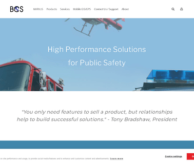
Law Enforcement Gear, Gis, Gps, Mapping, Ems, Public Safety, Esri, Trimble, Police, Fire, Cad, Rms, Addressing, Ambulance, Avl, Routing, Crime, Hotspots, Analysis, Data, Law Enforcement; Computer Networking Service; Innovative public safety GIS applications from BCS empower Police, Fire and EMS agencies to enhance protection and provide better services to their communities; Service ...

Rdo, Rdo Integrated Controls, Gis Mapping, GPS Mapping, Surveying, Agriculture Technology, Construction, Mining, Drone Technology, Drone, Drones, Drones for Sale, Sensefly; Rdo Integrated Controls Partners With Clients To Provide Cutting Edge Technologies and Drones for the Construction, Landfill and Mining Industries; Home Rdo Integrated Controls, Mining Industry ...
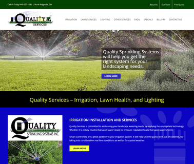
Garden Irrigation, Irrigation, Lawn Health and Low Voltage Lighting. Environmentally Sustainable Commercial & Residential Lawn Care, Fertilization Services and Sprinklers; Installation Services; Sprinklers; Design and installation of sprinkling systems. Products include drip system, lawn sprinklers and irrigation GPS mapping systems. Lawn health, irrigation installation and water saving services are available. Markets served include commercial and residential sectors ...

Deeper pioneered smart technology in angling with the first ever castable sonar. Since then, we have developed a range of products with features including Onshore GPS mapping and ice fishing. Now we are proud to announce a new addition to the Deeper family – the Deeper START our lightest ever model, ideal for shore anglers who just want to find the fish, Fishing Tackle ...

Avl & GPS & Mapping; Accountability Systems; Dispatch & Cad; Communication Solutions ...

Electronics & Controls & Instrumentation, Communications Cellular, Wireless; Electronics & Controls & Instrumentation, Communications Satellite; Electronics & Controls & Instrumentation, Controls; Electronics & Controls & Instrumentation, GPS Global Positioning Systems; Information Technology, GIS & Mapping; Information Technology, Inventory & Equipment Management; Information Technology, Power & Process & Plant & Utilities; Safety & Security, Alarms; Services, Fleet Management Systems, Construction Equipment ...
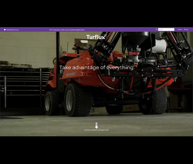
Golf Course GPS Systems; Golf Course Sprayers & Sprayer Equipment; GPS Satellite Controlled Sprayer Systems offered by Turflux are Game Changing in an Industry that is Judged by Quality But Desperately Looking for Cost Sontrol. to Learn How we can Convert your Existing Sprayer to take Advantage of Easy Benefits (E Nvironmental, a Ccuracy, S Avings, on Y our Sprayer). Powered by Raven's Slingshot Rtk a Turflux System can help you Achieve one Time Mapping, Sub Inch Repeatability, Advanced Nozzle, Golfing Accessories, Golf Course Equipment ...

Telecommunications, Mixed Telecommunications, Satellite Dish, Wireless, Haicom HI-603 Multifunction Real-time SMS/GPRS/DTMF Car GPS Tracker, Suitable for All Aspect of Tracking Applications with free mapping software, Our HI-603vt can do door/hood opened, window breakage, unauthorized start, towing, remote control short down of the car, speed control, Geofencing, history Data logger for up to 5years with free software ...

Electronics & Controls & Instrumentation, Communications Cellular, Wireless; Electronics & Controls & Instrumentation, Communications Satellite; Electronics & Controls & Instrumentation, GPS Global Positioning Systems; Information Technology, GIS & Mapping; Information Technology, Inventory & Equipment Management; Safety & Security, Alarms; Safety & Security, Anti Theft & Security Systems; Services, Computer Software; Services, Fleet Management Systems; Services, Telecommunications; Services, Construction Equipment ...

Land Surveyors, Surveying, Civil Engineering; Aerial Mapping, Surveying & Engineering Services; Land Surveying and Civil Engineering Houston Texas; Land surveying services Boundaries, topo, GPS, GIS ...

Property Surveying, Land Surveyor Connecticut, Ct, Property Lines Surveying, Staking, Survey Property, Fema, Loma, Eloma, Connecticut, Ct, Darien, Property, a 2, A2 Survey, Boundary Surveying & Mapping, Staking Property Lines, Weston, Wilton, Darien, Westport, Best Land Surveyor Stamford, Easton, Greenwich, Fairfield, Elevation Certificate, GPS Survey Control; Capabilities include property & boundary surveys, construction surveying & staking, topographic & site surveys, wetland delination mapping, land ...
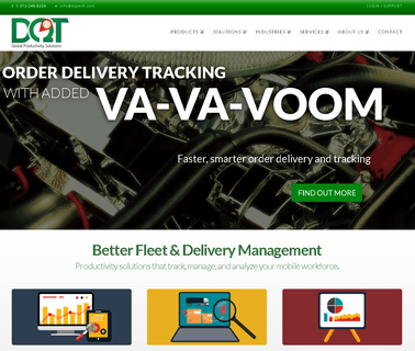
Dq Technologies, Software Solutions, Order Delivery Tracking, GPS Tracking Software, Mobile Workforce Management, Sales Force Management, Austin Texas, Home; Dq Technologies In Austin Texas Provides Software Solutions for Order Delivery and GPS Tracking, Integrated Mapping, Vehicle Maintenance, Mobile Workforce and Sales Force Management. Home; Dq Technologies - Delivery and Workforce Management Software System Expert, Austin, Texas - Home ...
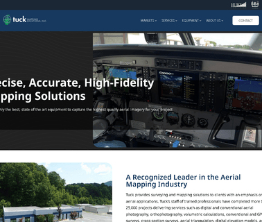
Engineering, Digital and Conventional Aerial Photography, Orthophotography, Volumetric Calculations, Conventional, Gps, and Cross-Section Surveys, Aerial Triangulation and Digital Elevation Models; Surveying and Mapping Services ...
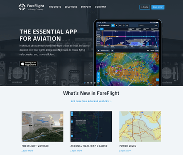
Aerial Imaging; Integration Services; Global Positioning Hardware & Software; Mapping Tools; Geographic Information Systems; Information Technology Products & Services; Weather Services; Computer Software Services & Consultants; GPS Services; Flight Planning Services ...

Surveying, Engineering, Land Surveying, Austin Texas Firms, Architect, Topography, Vertical Control, Horizontal Control, Gps, Carmelo Macias, Gino Macias, Construction, Level Loop, Boundary Survey, Plat; Surveying and mapping services. Services include engineering, contracting, architects, boundary, route, utility, land, leveling, construction, aerial control and global positioning system ...
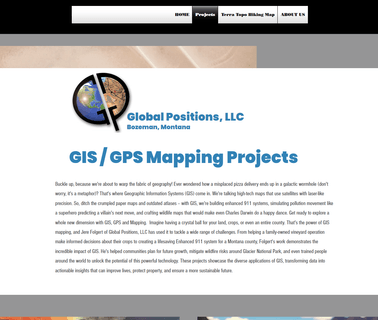
Gis, Mapping, Drone, Faa, Arcgis, Desktop, Training, Cartography, Award; Gis / GPS Mapping Firm; Consulting, Spatial Analysis, GPS Data Collection, Custom Mapping & Applications, Custom Integration, Software Development, System Integration & Assessment; GIS/GPS mapping firm. Consulting, spatial analysis, GPS data collection, custom mapping & applications, custom integration, software development, system integration & assessment ...