
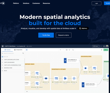
Visualization Software; Geographic Information Systems; Mapping Tools; Location Based Services ...

Cloud Computing; Geographic Information Systems; Mapping Tools; Aerial Imaging; Image Processing; Commercial Satellite Imaging; Information Technology Products ...

Visualization Software; Geographic Information Systems; Mapping Tools; Location Based Services ...

Electronics & Controls & Instrumentation, Communications Cellular, Wireless; Electronics & Controls & Instrumentation, Communications Satellite; Electronics & Controls & Instrumentation, Controls; Electronics & Controls & Instrumentation, GPS Global Positioning Systems; Information Technology, GIS & Mapping; Information Technology, Inventory & Equipment Management; Information Technology, Power & Process & Plant & Utilities; Safety & Security, Alarms; Services, Fleet Management Systems, Construction Equipment ...

Electronics & Controls & Instrumentation, Communications Cellular, Wireless; Electronics & Controls & Instrumentation, Communications Satellite; Electronics & Controls & Instrumentation, GPS Global Positioning Systems; Information Technology, GIS & Mapping; Information Technology, Inventory & Equipment Management; Safety & Security, Alarms; Safety & Security, Anti Theft & Security Systems; Services, Computer Software; Services, Fleet Management Systems; Services, Telecommunications; Services, Construction Equipment ...
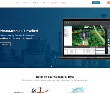
Engineering Services; Information Technology Products; Visualization Software; Mapping Tools; Cloud Computing; Geographic Information Systems; Integration Services; Training & Simulation; Command, Control, Communications & Computers; Aerial Imaging; Image Processing ...

Electronics, Controls, Instrumentation Computer Software; Information Technology Computer Hardware & Peripherals; Information Technology Financial Management, Project Accounting, Accounting Services; Information Technology Gis, Mapping; Information Technology Internet Solutions, Networking; Information Technology Inventory, Equipment Management; Information Technology Management Consulting, Asphalt Equipment, Heavy Construction ...

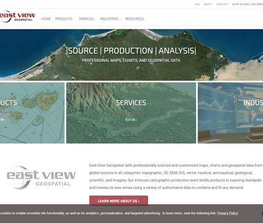
Visualization Software; Commercial Satellite Imaging; Image Processing; Mapping Tools; Aerial Imaging; Information Technology Products; Geographic Information Systems; Location Based Services ...

Visualization Software; Research & Development; Consulting Services; Global Positioning Hardware & Software; Mapping Tools; Commercial Satellite Imaging; Image Processing; Geographic Information Systems; Location Based Services ...
Simulation & Modeling & Training; Mapping Tools; Cloud Computing; Consulting Services; Integration Services; Aerial Imaging; Geographic Information Systems; Commercial Satellite Imaging; Image Processing ...

Brand Licensing Integrated Security Surveillance Systems Cybersecurity Big Data Analysis Applications Border Management Perimeter Protection Solutions Command and Control Geographic Information Gis Geospatial Intelligence Intruder Detection Towers Coastal Safe Cities Counter Terrorism Investigations Gunshot Location Mapping Tracking Public Safety Technologies Predictive Policing Communications Equipment ...
Mapping Tools; Geographic Information Systems; Integration Services; Information Technology Products & Services ...
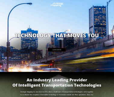
ADA Compliant Products, Automated Vehicle Monitoring, Communications Equipment, Intelligent Transport Systems Technology, Passenger Information Systems, Signage and Displays, Public Trasportation, Public Transportation ...
Visualization Software; Consulting Services; Image Processing; Mapping Tools; 3D Mapping Software & Tools; Gis Software; Aerial Imaging; Information Technology Products; Geographic Information Systems; Location Based Services ...
Aerial Imaging; Integration Services; Global Positioning Hardware & Software; Mapping Tools; Geographic Information Systems; Information Technology Products & Services; Weather Services; Computer Software Services & Consultants; GPS Services; Flight Planning Services ...

Visualization Software; Simulation & Modeling & Training; Engineering Services; Image Processing; Research & Development; Consulting Services; Integration Services; Geographic Information Systems; Mapping Tools ...