
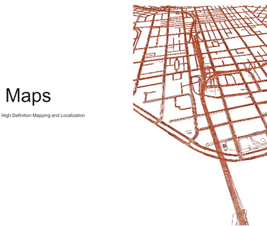
Mapping, Design, CAD, GIS; Network Management; Software, Applications; Telecommunications Services; Workforce Managements Systems; NOC Tools & Systems; Software Defined Network, Cable Telecommunications ...
Mapping Tools; Geographic Information Systems; Integration Services; Information Technology Products & Services ...

Antennas, Antennas; Imaging Equipment; Locators; Monitors; Radar Components; Radar Systems; Software; Trucks and Carts ...
Engineering, Digital and Conventional Aerial Photography, Orthophotography, Volumetric Calculations, Conventional, Gps, and Cross-Section Surveys, Aerial Triangulation and Digital Elevation Models; Surveying and Mapping Services ...

LiDAR Drone Mobile Mapping High Precision Navigation and Advanced Sensing for Land, Air & Sea Support. See what Geodetics can do for you ...

Consulting Services; Geological Services; Inspection Services; Investigation Services; Remediation Services ...

Law Enforcement Gear, Skyimd Develops Aerial Camera Platforms and Imaging Solutions and for Planes and Helicopters. we Utilize the Latest in Video, Dslr, Remote Sensing and Infrared Technologies; Cameras; Imaging Equipment; Monitors; Sensors, Detectors, Transducers; Surveillance Equipment; Design and installation of surveillance video and communications systems. Products include imaging, motion detection and moving map systems. Applications include law enforcement, military, government, wildfire management, oil and gas ...

Fire & gas detection engineers & consultants. Specialists in visual flame detection systems and fire & gas mapping studies for the oil & gas industry ...
Infrared Inspection, Infrared Testing, Infrared Services, Vector Mapping, Electronic Leak Detection, Roof Moisture Surveys, Thermography, Building Envelope, Roof Scan, Infrared, Thermographers, Electrical Scans, Efvm, Mechanical Scans, Steam System Inspections, Heat Loss, Nondestructive Testing, Analysis, Infra-Red; Roofing & Energy Consulting Service; Infrared inspections, vector mapping, electronic leak detection, roof moisture surveys, building envelope analysis, infrared electrical scans, infrared ...

Land Surveyors, Surveying, Civil Engineering; Aerial Mapping, Surveying & Engineering Services; Land Surveying and Civil Engineering Houston Texas; Land surveying services Boundaries, topo, GPS, GIS ...
Augmented Reality & Virtual Reality; Sensors, 3D Edge Mapping; Automotive & Vehicle Technology, Virtual Reality ...
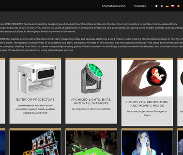
Stage Projectors and Projector Devices, Lighting Technology, Spotlights and Projectors, Projectors and Colour Changers, Lighting Technology, Spotlights and Projectors, Projector, Projections, 3D Mapping, Virtual Hostess, Interactive System, PROJECTOR IMPRESSIVE 2000W, GOBOS, INTERACTIVE SYSTEM, VIRTUAL HOSTESS, 3D MAPPING PROJECTION, Professional Lights, Commercial Sound Equipment, Office Electronics, Presentation Equipment ...
Electronics, Controls, Instrumentation Computer Software; Information Technology Computer Hardware & Peripherals; Information Technology Financial Management, Project Accounting, Accounting Services; Information Technology Gis, Mapping; Information Technology Internet Solutions, Networking; Information Technology Inventory, Equipment Management; Information Technology Management Consulting, Asphalt Equipment, Heavy Construction ...
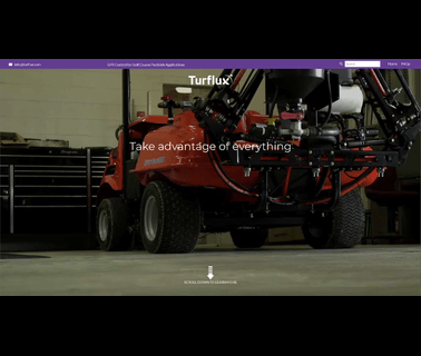
Golf Course GPS Systems; Golf Course Sprayers & Sprayer Equipment; GPS Satellite Controlled Sprayer Systems offered by Turflux are Game Changing in an Industry that is Judged by Quality But Desperately Looking for Cost Sontrol. to Learn How we can Convert your Existing Sprayer to take Advantage of Easy Benefits (E Nvironmental, a Ccuracy, S Avings, on Y our Sprayer). Powered by Raven's Slingshot Rtk a Turflux System can help you Achieve one Time Mapping, Sub Inch Repeatability, Advanced Nozzle, Golfing Accessories, Golf Course Equipment ...
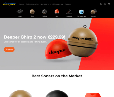
Deeper pioneered smart technology in angling with the first ever castable sonar. Since then, we have developed a range of products with features including Onshore GPS mapping and ice fishing. Now we are proud to announce a new addition to the Deeper family – the Deeper START our lightest ever model, ideal for shore anglers who just want to find the fish, Fishing Tackle ...
Harxon is committed to providing the best performance GNSS products for global customers, in the fields of surveying and mapping, UAVs, intelligent transportation, aerospace, deformation monitoring, autopilot, precision agriculture. Also, offering industrial solutions of satellite communications and data transmission ...