
Mapping, Photogrammetry, Software, Aerial Triangulation, Dsm, Point Cloud, Dtm, Orthomosaic, Mosaic, Drone, Aircraft, Satellite, Uav, Agriculture, Surveying, Emergency Response, Environmental Monitoring; High End Mapping Software, Rapid processing of imagery from drones, aircrafts and satellites. Start mapping today with Correlator3D ...

Cloud Computing; Geographic Information Systems; Mapping Tools; Aerial Imaging; Image Processing; Commercial Satellite Imaging; Information Technology Products ...

Applanix, a wholly owned subsidiary of Trimble, builds, delivers, and supports products and solutions designed specifically for the unmanned aerial survey industry. Our DG technology works with UAV mapping sensors – including cameras, LiDAR, and hyperspectral sensors – to perform highly efficient mapping and surveying from a UAV. applanix ...

Strategic Mapping is a hardware designer, software application service provider and system integrator dedicated to providing Intelligent Transportation Systems (ITS); Our solutions assist transit agencies in making their services more efficient and attractive while enhancing the passenger experience while mobile and onboard; the flexibility of our technologies has enabled us to serve transit agencies ranging from smaller community based transits to some of the largest in the World; Strategic Mapping, Public Transportation ...

Visualization Software; Research & Development; Cloud Computing; Engineering Services; Mapping Tools; Aerial Imaging; Geographic Information Systems; Commercial Satellite Imaging; Image Processing ...

GEM Systems to discuss your UAV geophysical needs; Given the increase in popularity of UAV platforms, GEM Systems has specifically designed a lightweight and ultra sensitive magnetometer and gradiometer for UAV applications such as aerial mapping, mineral exploration, pipeline and & or wellhead detection, Unexploded Ordnance Target Identification (UXO) #DRONEMag, Petroleum Equipment ...

xsensor Technology Corporation Offers the Most Accurate Pressure Imaging Sensors on the Market Today Including Test and Measurement, Patient Monitoring; Connectors; Platforms; Sensors, Detectors, Transducers; Software; Innovator in the field of pressure imaging systems providing pressure mapping software, pressure imaging sensors & platforms & accessories ...
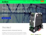
Avidbots offers the innovative Neo, a self driving floor scrubber that enables commercial cleaning teams to increase productivity and enhance service. Avidbots robotics experts have integrated a best in class navigation, mapping, and autonomy system with the highest quality parts and technology. This proven, reliable solution reduces labor requirements for cleaning large commercial spaces such as colleges, Robotics Parts ...

Leica Geosystems, Hexagon Geosystems, Geospatial Solutions, Surveying, Engineering, Reality Capture, Monitoring, Mining, Agriculture, Positioning and Analysing Solutions, Spatial Measurement, Measurement and Spatial Technologies, Capture Spatial Information, Analyse Spatial Information, Laser Scanning, 3D Scan, Mobile Mapping Solutions, Gnss Systems, Gnss Reference Networks, Airborne Systems, Lidar, Machine Control Systems, Construction Tps & Gmss, Locators, Lasers, Levels, Gis Collectors, Laser ...