
Science and Technology Provider; Computer Systems & Software; Satellite Information Systems; Traceability Solutions, Wind Power, Computer Systems ...

Visualization Software; Commercial Satellite Imaging; Image Processing; Mapping Tools; Aerial Imaging; Information Technology Products; Geographic Information Systems; Location Based Services ...
Revenue Management Solutions, Telecom Billing Systems, Telecom Billing Software, Cable and Satellite Billing, Convergent Billing System, Customer Interaction Management; From Revenue Management Solutions To Telecom Billing Systems, Over 500 Communication Service Providers Trust Csg International. Us Today; Csg International Revenue Management and Telecom Billing, Broadcasting, Electronic Media ...

Kubos is bringing the software revolution to space, one small satellite at a time. Satellite software development today is an outdated and broken process, and we’re determined to make it better, faster, productive than ever. Kubos will de risk your mission with space grade software and savvy, ongoing support ...
Engineering Services; Information, Research Services; Software; the Leading Provider of Enterprise Systems, Databases and Tools for Satellite Capacity Planning, Management, and Vsat Network Design and Optimization. Our Products Include Enterprise Capacity Manager (Ecm), Complan, Comsat Star Suite, and Customer Link Budget Tool. We Specialize in Systems that Integrate Capacity Engineering, Technical Operations, Customer Support and Billing, Satellite Components ...

Visualization Software; Research & Development; Consulting Services; Global Positioning Hardware & Software; Mapping Tools; Commercial Satellite Imaging; Image Processing; Geographic Information Systems; Location Based Services ...
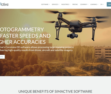
SimActive is the developer of Correlator3D software, a patented end to end photogrammetry solution for the generation of high quality geospatial data from satellite, aerial imagery and UAVs. Correlator3D performs aerial triangulation and produces DSMs, DTMs, orthomosaics and vectorized 3D features ...

Mapping, Photogrammetry, Software, Aerial Triangulation, Dsm, Point Cloud, Dtm, Orthomosaic, Mosaic, Drone, Aircraft, Satellite, Uav, Agriculture, Surveying, Emergency Response, Environmental Monitoring; High End Mapping Software, Rapid processing of imagery from drones, aircrafts and satellites. Start mapping today with Correlator3D ...
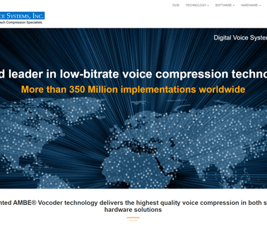
Digital Voice Systems, Low Bit Rate, Voice, Compression, Mobile Radio, Vocoder, Apco, Gmr1, Gmr2, Mototrbo, Dmr, Dpmr, Satellite, Ambe+2, Ambe 3000, Usb 3000, Usb 3000 Project 25, Ambe+, Ambe, Net 2000, Imbe, Dvsi, P25, Aces, Thuraya, Inmarsat, Bgan, Mini M, Iridium, Compression, Toll Quality, Celp, Mos, Ambe 2000, Ambe 2020, Vc 20, Nxdn, Satellite, Wireless Communication, Vocoder Software, Speech Sample, Digital Voice, Low Data Rate, Low Bit Rate; Digital Voice Systems, is a world leader in, Telecommunication Equipment ...

Cloud Computing; Geographic Information Systems; Mapping Tools; Aerial Imaging; Image Processing; Commercial Satellite Imaging; Information Technology Products ...
Romantis is a Global Provider of Space Segment Capacity and Leading Edge Satellite Networking Equipment. the Group Manages 600 Mhz of Satellite Resource, Operates Own Vsat and Dvb Platforms and Produces the Innovative Uhp Product the Industry's first Fully Software Defined Satellite Router that Supports any Topologies and Operation Modes, Satellite Components, Networking Devices ...

Fibre Interfaces and Systems; Playout; Radio Transmitters; Playout; Rf Accessories; Playout; Satellite Ground Stations (Fixed Uplinks); Playout; Television Transmitters; Training; Terestrial Broadcast Transmission; Test, QC & Monitoring; Test and Measurement Equipment and Software, Broadcasting, Electronic Media ...

Telecommunications, Mixed Telecommunications, Satellite Dish, Wireless, Haicom HI-603 Multifunction Real-time SMS/GPRS/DTMF Car GPS Tracker, Suitable for All Aspect of Tracking Applications with free mapping software, Our HI-603vt can do door/hood opened, window breakage, unauthorized start, towing, remote control short down of the car, speed control, Geofencing, history Data logger for up to 5years with free software ...

Electronics & Controls & Instrumentation, Communications Cellular, Wireless; Electronics & Controls & Instrumentation, Communications Satellite; Electronics & Controls & Instrumentation, GPS Global Positioning Systems; Information Technology, GIS & Mapping; Information Technology, Inventory & Equipment Management; Safety & Security, Alarms; Safety & Security, Anti Theft & Security Systems; Services, Computer Software; Services, Fleet Management Systems; Services, Telecommunications; Services, Construction Equipment ...
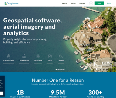
Roof Measuring, Roof Measurement, Roofing Measurement, Roof Measurement Reports, Satellite Measurement, Aerial Measurement, Orthographic, Roof Measurement, Imagingestimate, Estimator, Report, Diagram, Takeoff, Software, Program, Adjuster, Contractor, Measure, Measurement, Wall Measurement, Pitch, Grade, Shingle, Square, Walls Measurement, Drip, Eave, Edge, Gable, Mansard, Roof, Roofing, Facet, Measuring Walls, Dotnetnuke, Dnn, Eagleview Technologies Specializes in Automating Manual Processes Through ...

Nsi Mi Technologies Offers a Comprehensive Range of Industry Leading Microwave Test Systems. These Systems Cover Antennas, Radomes and Rcs and our Unique Blend of Mechanical, Rf and Software Engineering Capabilities allow us to Customize Test Systems to offer Specialized Solutions. Nsi Mi Supports the Aerospace/Defense, Automotive, Wireless and Academic Industries, Satellite Components, Antennas ...