

Electronics & Controls & Instrumentation, Communications Cellular, Wireless; Electronics & Controls & Instrumentation, Communications Satellite; Electronics & Controls & Instrumentation, Controls; Electronics & Controls & Instrumentation, GPS Global Positioning Systems; Information Technology, GIS & Mapping; Information Technology, Inventory & Equipment Management; Information Technology, Power & Process & Plant & Utilities; Safety & Security, Alarms; Services, Fleet Management Systems, Construction Equipment ...

Visualization Software; Commercial Satellite Imaging; Image Processing; Mapping Tools; Aerial Imaging; Information Technology Products; Geographic Information Systems; Location Based Services ...

Simulation & Modeling & Training; Mapping Tools; Cloud Computing; Consulting Services; Integration Services; Aerial Imaging; Geographic Information Systems; Commercial Satellite Imaging; Image Processing ...

Pix4D is Specialized in Professional Drone Mapping Software to Produce 2D Orthomosaics, 3D Models, Digital Surface Models, Point Clouds and More, all from Images. Using Deliverables from Pix4D Software that are Bim Compatible, Construction Managers can Monitor Construction Site Progress Enabling them to View the As-Built Situation of the Site for Up-To-Date Measurements and Continued Analysis, Making Earthwork Management and Detailed Virtual Inspections more Efficient ...

Cloud Computing; Geographic Information Systems; Mapping Tools; Aerial Imaging; Image Processing; Commercial Satellite Imaging; Information Technology Products ...
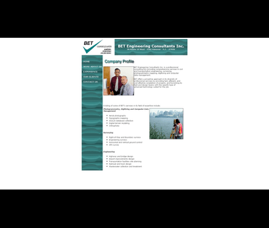
BET Engineering Consultants DBE firm, SBE firm, mapping, surveying, engineering; engineering services; inspection services; maps; surveying services ...

Licensed Land Surveyor 3D mapping the Southeastern United States, using 3D laser scanning, Hydrographic and Aerial Surveying; surveying & mapping services including construction, elevation, hazardous sites & wetlands; project management services ...

With the most comprehensive catalog of elearning courses from the world’s top publishers, OpenSesame can help you every step of the way, from finding courses, mapping them to your core competencies, syncing them seamlessly with your LMS to increasing utilization and continuously improving your L & D programs. Not only will you have the flexibility of multiple purchasing options from OpenSesame, you’ll find it simple ...

Consulting Services; Geological Services; Inspection Services; Investigation Services; Remediation Services ...

Land Surveying Lansing, Surveying, Land, Survey, Landsurveyor, Surveyor, Geodetic, Designs, Lansing, Surveys, Alta/Acsm, Alta, Mortgage, Boundary, Topographical, Topo, Topographic, Property, Split, Parcel, Gps, Staking, Construction, Floodplain, Surveyors, Dewitt, Holt, Stakeout, Plotplan, Act132, Property Surveyor, Geodetic Surveyor, Topographic Map, Land Surveyor, Land Surveying, Michigan Surveying, Michigan Land Surveying, Michigan Surveying, Illinois Surveying, Indiana Surveying, Louisiana ...

Avl & GPS & Mapping; Accountability Systems; Dispatch & Cad; Communication Solutions ...

Antennas, Antennas; Imaging Equipment; Locators; Monitors; Radar Components; Radar Systems; Software; Trucks and Carts ...

Law Enforcement Gear, Gis, Gps, Mapping, Ems, Public Safety, Esri, Trimble, Police, Fire, Cad, Rms, Addressing, Ambulance, Avl, Routing, Crime, Hotspots, Analysis, Data, Law Enforcement; Computer Networking Service; Innovative public safety GIS applications from BCS empower Police, Fire and EMS agencies to enhance protection and provide better services to their communities; Service ...

Peptide Array, Peptide Arrays, Peptide Microarray, Epitope Mapping, Peptide Mapping; PEPperPRINT provides peptide microarrays, custom peptides as well as NHS coated glass slides and offers full analysis service, Construction Glass ...

Fire & gas detection engineers & consultants. Specialists in visual flame detection systems and fire & gas mapping studies for the oil & gas industry ...

Applanix, a wholly owned subsidiary of Trimble, builds, delivers, and supports products and solutions designed specifically for the unmanned aerial survey industry. Our DG technology works with UAV mapping sensors – including cameras, LiDAR, and hyperspectral sensors – to perform highly efficient mapping and surveying from a UAV. applanix ...